
About Ohio Geographically Referenced Information Program (OGRIP) The Ohio Geographically Referenced Information Program (OGRIP) operates within the Ohio Department of Administrative Services as the State of Ohio’s central GIS authority. OGRIP supports the OGRIP Council, the official coordinating body for state and local government GIS activities, and maintains the GIS Support Center, providing GIS services […]

Overview When England-Thims & Miller’s (ETM) Geospatial Technologies team set out to expand their client-facing solution, DeepVUE Geospatial, they quickly realized their on-prem and Azure environments couldn’t keep up with demand. Frequent outages, limited IT bandwidth, and scalability challenges threatened growth. By partnering with ROK Technologies, ETM successfully migrated DeepVUE to Amazon Web Services (AWS) […]
Discover how the Nevada Department of Transportation (NDOT) successfully migrated from on-premise infrastructure to the Cloud with the help of ROK Technologies. Learn about the challenges they overcame, the benefits they gained, and the new opportunities that emerged.

This success story delves into the critical operational challenges, the transformative benefits of partnering with ROK, and the promising future that lies ahead for this dynamic partnership for Gewalt Hamilton Associates, Inc.

Company Background Astound Broadband is an award-winning internet and cable provider that serves eight of the top ten metro markets in the United States. They aim to expand into future markets with a continued focus on customer service and providing critical infrastructure to local communities. Astound Broadband utilizes fiber to the home (FTTH) technology, which […]
The City of Lebanon invests in GIS The City of Lebanon relies on a small network of GIS employees to support its day-to-day functions from emergency response such as the police and fire departments to the utilities such as water, sewer, and gas departments. The GIS department’s efforts support an estimated 38,000 citizens and nearly […]

01 Amplifying a Small Team with Big Plans Before the City of Hastings migrated their GIS to the Cloud seven years ago, they had an on-premise server that was mainly for hosting three websites for public viewing. The three websites functioned as informational for both employees and the public. The City relied on their IT […]
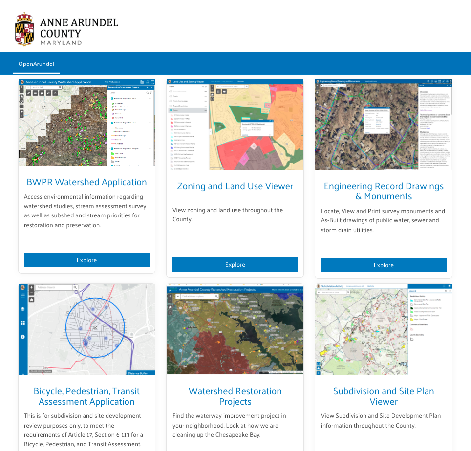
Anne Arundel County’s Commitment to Accelerate Digital Transformation This transformation commitment creates a more effective and efficient county government for employees, citizens, and communities. To effectively support every citizen of Anne Arundel County with the standardization, coordination, and dissemination of geographic information requires a GIS infrastructure that facilitates collaboration – and is both scalable and reliable. Power […]
Fishbeck is an all-in-one solutions provider with 14 regional offices and over 500 staff members in the Midwest – Michigan, Ohio and Indiana. Founded in 1965, they are one of the premier professional consulting firms in the nation. Engineering, environmental sciences, architecture, and construction management are the cornerstones of Fishbeck’s services and integrated project approach. […]

About MassDOT MassDOT constantly strives to support the economic, quality of life, and environmental goals of the Commonwealth of Massachusetts. That’s why MassDOT engaged ROK Technologies to architect a cloud solution that would facilitate their mission of providing transportation infrastructure, which is safe, reliable, robust, and resilient. When they shared our problems with us, we […]


