About Ohio Geographically Referenced Information Program (OGRIP)
The Ohio Geographically Referenced Information Program (OGRIP) operates within the Ohio Department of Administrative Services as the State of Ohio’s central GIS authority. OGRIP supports the OGRIP Council, the official coordinating body for state and local government GIS activities, and maintains the GIS Support Center, providing GIS services to agencies throughout Ohio. As the backbone of Ohio’s statewide spatial data infrastructure, OGRIP’s work reaches every level of government and every resident of the state.
“GIS is the core mission of OGRIP,” said Donovan Powers, Ohio Geographic Information Officer. “We serve all citizens of Ohio by bringing together the GIS community of our state. We do this by providing a means for the government to efficiently share, display and collaborate geographic information.”
About the Ohio Statewide Imagery Program (OSIP)
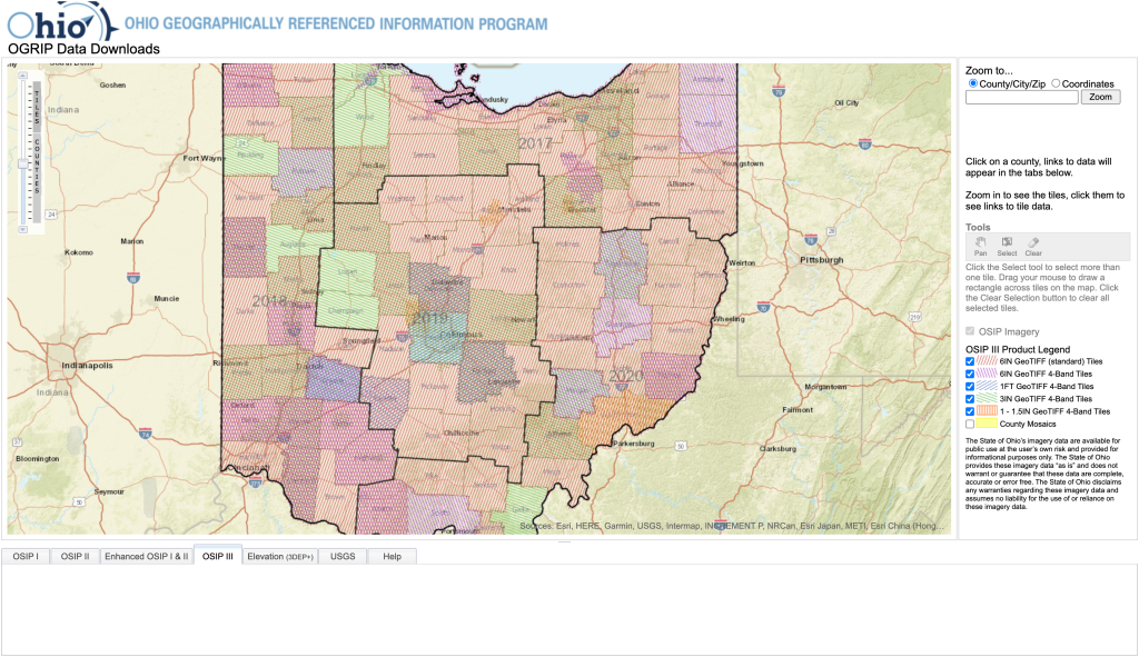
One of OGRIP’s highest-profile responsibilities is the Ohio Statewide Imagery Program (OSIP), a partnership between state, county, and municipal government agencies dedicated to developing and maintaining high-resolution imagery and elevation data for the benefit of all GIS users across Ohio. Accurate imagery and elevation data serve as the foundation for geospatial datasets accessed by government decision-makers and the public alike.
About Donovan Powers, Ohio Geographic Information Officer (GIO)
As Ohio’s top GIS executive leader, Donovan Powers oversees OGRIP and its responsibilities for statewide data collection and collaboration between all levels of government. Donovan also brings firsthand experience partnering with ROK Technologies from his prior role at the Ohio Department of Natural Resources, where ROK first helped modernize their GIS environment beginning in 2021. He brought that proven partnership with him when he moved to OGRIP, making ROK his first call when it came time to modernize Ohio’s central GIS infrastructure.
01
OGRIP’s Challenge: A growing imagery library, a shrinking capacity to manage it
As Ohio’s centralized GIS hub, OGRIP manages one of the state’s largest and most consequential data assets: a 40-terabyte imagery library. The system served every government agency in Ohio, yet the team tasked with maintaining it had no room to keep pace with its demands.
The core problems were ones familiar to many state GIS programs: enterprise GIS is a niche discipline; qualified talent is scarce; and on-premises infrastructure can be expensive. “GIS for enterprise-level servers is a very niche technology,” said Powers. “Finding employees with the skills and experience necessary to manage these environments is challenging. Keeping institutional knowledge is even more challenging should your expert move on from your team.” At OGRIP, one employee shouldered the weight of managing all GIS server infrastructure. “We had only one employee that managed our GIS servers and that person was being used for many other things,” Powers explained. “We simply didn’t have time to dedicate to upgrading and maintaining the enterprise server environment appropriately.”
The stakes could not have been higher. OGRIP’s environment carries strict high-availability requirements: the statewide imagery it serves, the geocoding infrastructure it operates, and the GIS applications it supports cannot tolerate outages. Yet maintaining that level of uptime had become an unsustainable ask of an already stretched team; one with too many competing priorities and too few people to dedicate to it. Meanwhile, demand was growing. OGRIP had plans to expand its GIS footprint in support of OSIP, but the existing team capacity simply could not absorb more. The imagery library itself compounded the problem. All 30 terabytes sat on costly on-premises SAN hardware that was expensive to store, slow to serve, and difficult for agencies across the state to access reliably. As the imagery library grew, it became harder to maintain and further behind where it needed to be.
02
The Solution: A Cloud-native imagery architecture built for Ohio
Phase 1: An easy Cloud migration
Powers had already navigated one ROK-assisted cloud migration at Ohio Department of Natural Resources, so when it came time to modernize OGRIP, he knew exactly what to expect. The reality more than matched his confidence.
“Moving to the Cloud ended up being very satisfying and worry-free. I have now been through this on two occasions, and both were worry-free.”
— Donovan Powers, Ohio Geographic Information Officer
ROK migrated OGRIP’s ArcGIS Enterprise environment to Amazon Web Services (AWS) and provides Managed Cloud Services, managing, maintaining, and upgrading all server infrastructure. This shifted the burden of day-to-day administration away from OGRIP’s lean team and gave them access to an entire bench of GIS, cloud, and IT professionals — rather than depending on a single internal resource to keep mission-critical systems running.
Phase 2: 30TB Imagery migration and Cloud optimization
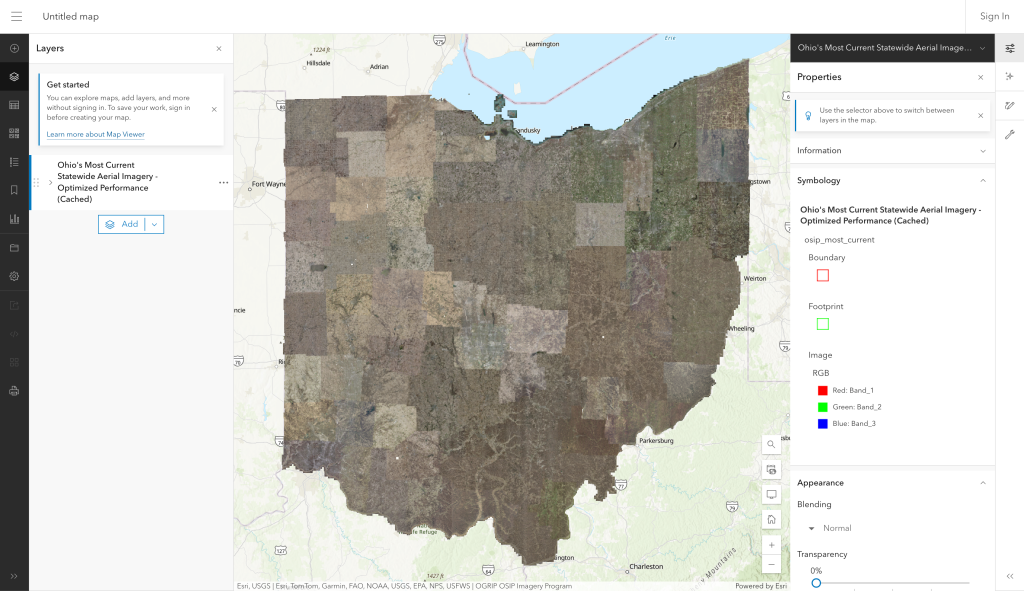
The signature achievement of ROK’s work for OGRIP was the migration and transformation of 30 terabytes of on-premises imagery into a high-performance, cloud-native asset. ROK engineered a novel architecture to make this possible at statewide scale.
The raw imagery was first synced to an Amazon S3 bucket for scalable, low-cost storage. Using ArcGIS Pro, ROK’s team then processed the statewide raster collection by building multiple mosaic datasets for different geographic regions across Ohio which were then consolidated into a single, comprehensive “mosaic dataset of mosaic datasets.” This approach, pioneered by ROK’s technical team, created a unified logical index for Ohio’s entire imagery library, enabling preprocessing, optimization, and cache generation at a scale that had not been attempted before.
To learn more about the origin of this approach, check out “Tiles on a Cloud: Cloud computing and ArcGIS Server deliver a thrifty solution”
To optimize the master dataset for performance, overviews were built generating pre-rendered lower-resolution versions of the imagery that dramatically improve display speed across all zoom levels. The optimized dataset was then used to generate a statewide map tile package, which ROK deployed directly back to S3 as a high-performance, servable cache. The architecture was completed by publishing the S3-hosted cache as a raster tile layer within ArcGIS Portal, creating a single, unified source of truth for Ohio’s entire imagery library.
Critically, this approach shifts all performance burden away from ArcGIS Server, maximizing bandwidth utilization and eliminating duplication across the entire state.
Phase 3: Zero-downtime ArcGIS Enterprise upgrade
In January 2026, ROK performed a blue-green ArcGIS Enterprise upgrade for OGRIP elevating their environment to ArcGIS Enterprise 11.5 with zero service interruption. ROK deployed a brand-new “green” environment in parallel with the existing “blue” environment, migrated all data and configurations, then seamlessly transitioned users from one to the other at the flip of a switch. For an organization with strict high-availability requirements, delivering a major platform upgrade without a single moment of downtime was a defining demonstration of ROK’s operational discipline.
Today: Ongoing imagery lifecycle management & server support
As OGRIP acquires new imagery on an annual cadence, ROK continues to process and publish each new collection receiving the raw data format and transforming it into a performant, Cloud-native layer within the ArcGIS environment. This ongoing partnership ensures Ohio’s imagery stays current and continues to power OSIP as the state’s definitive source for high-resolution spatial data.
Additionally, OGRIP operates a geocoding server that supports the entire State of Ohio. ROK has assisted with the deployment of StreetMap Premium for geocoding, full cloud infrastructure management, performance tuning, troubleshooting, and optimization — ensuring this critical statewide service remains fast, reliable, and ready.
Solutions Snapshot
- 30TB imagery migrated to Amazon S3 as Cloud Optimized GeoTIFFs (COGs)
- Mosaic dataset of mosaic datasets: the single source of truth for all of Ohio
- High-performance VDI for cache processing: scale up to process, scale back down to save cost
- Raster tile layer published in ArcGIS Portal so the performance burden shifted off ArcGIS Server
03
The Top 3 Benefits
1. A productivity multiplier for a lean team
With ROK managing the infrastructure, OGRIP’s team can focus on their mission rather than their machines. The shift from reactive server management to proactive, partner-managed operations has fundamentally changed what the team can accomplish.
“Having a managed service provider has been a significant boost to our productivity. Having this in a Cloud environment has made it much faster to provision new servers, increase server resources, add new configurations and upgrade Esri software without any worries.”
— Donovan Powers, Ohio Geographic Information Officer
2. Seamless, zero-downtime upgrades
For a statewide GIS authority that cannot afford service interruptions, delivering a complete platform upgrade without a single moment of downtime validated everything OGRIP had come to expect from ROK.
“The work ROK is doing for OGRIP is high quality and extends our capabilities significantly.”
— Donovan Powers, Ohio Geographic Information Officer
3. Ohio’s own imagery is better than Google maps
Perhaps the most valuable outcome of ROK’s imagery work is the product itself: a statewide, high-resolution imagery layer covering all of Ohio at detail levels that surpass commercial mapping products built entirely on data that OGRIP owns. The result directly powers the Ohio Statewide Imagery Program, making authoritative, Cloud-native imagery available to every government agency and GIS user across the state.
04
In Conclusion: A trusted partnership
For OGRIP, the partnership with ROK Technologies has delivered far more than infrastructure management. It has enabled Ohio’s central GIS authority to fulfill its mission at a scale and speed that would have been impossible to achieve alone and to stand up one of the most sophisticated statewide imagery platforms in the country.
From the initial Cloud migration to the ongoing management of 30 terabytes of statewide imagery, to a flawless zero-downtime platform upgrade, to the geocoding infrastructure serving every corner of Ohio, OGRIP found a partnership with ROK that doesn’t just handle the technical work but advances what’s possible.
The successful partnership with OGRIP is just one of many real-world client proof points behind ROK’s recognition as one of the first Esri partners to earn the ArcGIS Imagery Specialty designation in 2026.
Esri’s Global Business Director of Imagery and Remote Sensing, Beau Legeer, captured what this partnership represents: “ROK Technologies shows how Cloud-based systems can make imagery faster, more affordable, and more useful for organizations. They’ve proven that modernizing how imagery is stored and accessed transforms it into real business intelligence.”